Sunday, May 31, 1992

31 May 1992: Flagstaff, Arizona to Albuquerque, New Mexico

We ate breakfast at a truck stop diner next to the Motel 6 in Flagstaff, Arizona, then we were back on Interstate 40 again.

Scenery along the way

35 miles (56 km) east we stopped to see the famous Barringer Crater formed by a meteorite collision 50,000 years ago. It's 4000 feet (1200 m) in diameter and 570 feet (170 m) deep, punched into the ground with a force equivalent to a large thermonuclear blast. So a really big hole in the ground, and too large to photograph more than a portion at a time.

Part of the Barringer Crater

Part of the Barringer Crater

Floor of the Barringer Crater

Astronauts trained in the crater in the 1960s for future missions to the Moon, and there's an actual Apollo test capsule on exhibit at the visitor center. We toured the rim of the crater and the visitor center, and I recall purchasing some petrified wood and gemstones in the gift shop. The full tour was at least a couple of hours, including a film presentation, so afterward we had lunch at the cafeteria.

My mother and grandmother next to the Apollo test capsule

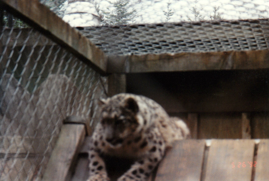
Then we were back on the road for another 128 miles (206 km). Somewhere during this part of the trip we stopped at a national park where there were pueblo ruins situated on the side of a steep canyon wall. I don't remember the name of the park, though. I wore a t-shirt proclaiming that Columbus was an invader, and one of the park rangers said he liked it. We went as far as we could toward the actual ruins. Although we could have gone further, the path was treacherous from there, and we wisely turned back.

Pueblo ruins

Pueblo ruins

Interstate 40 parallels sections of the famous Route 66 that still exist, and at one point we drove along one of those still existing sections and stopped at a gift shop located in what was once a Depression-era service station.

In Gallup, New Mexico, we turned north onto what is now U.S. Route 491, which was still designated as U.S. Route 666 at that time. This route took us onto the Navajo Nation reservation.

We drove quite a distance onto the reservation, stopping in a small town to replenish our supply of beverages and snacks at a trading post/gas station. On our way out of town, we pulled off to the side of the road so I could take some landscape photos. From seemingly out of nowhere, three dogs surrounded the car.

Two of them stood at the driver and passenger doors and barked at us, while the third stood in front of the car barking at the front bumper as if he'd never seen an automobile before. No matter how much we yelled or honked the horn, the dogs wouldn't stop barking or leave.

We didn't want to run over them and backing up would have required backing into a blind spot on the road, so my mother rolled down the passenger window enough to throw some of the snacks we'd just purchased out on the ground. It took most of the snacks to finally lure the dogs away, and we drove off as the dogs were happily eating.

Once we were back on Interstate 40, we stopped at a gift shop operated by a Zuni man who sold Kachina dolls. My mother's best friend collected them, so she bought one and had it packaged for shipping. We mailed it to her friend the next day.

In the distance, we could see dark storm clouds on the western horizon, so we decided to get to our destination of Albuquerque, New Mexico, 140 miles (225 km) east, as soon as possible.

We arrived at the De Anza Motor Lodge, which was opened in 1939 and later closed in 2003, in the early evening. The motel was located on Central Avenue, which until 1985 had been known as Route 66.

We were dismayed to find that there was no on-site restaurant, as the AAA travel guidebook had said there was. It had closed permanently the day before. Just our luck. So we had pizza delivered from Pizza Hut for dinner. We were tired, and didn't feel like going out to find a restaurant.

There was some drama when my mother and grandmother discovered that their room was not exactly sparkling clean. The pillowcase on my mother's bed looked like someone with very greasy hair had been sleeping on it, while the towels in the bathroom were dirty. The AAA travel guidebook rated the motel high for cleanliness, so this was a surprise. A call to the office resulted in clean linen and towels for my mother and grandmother. My room was clean, however.

On the evening news we discovered that the storm we saw was going to move into the area the next morning, so we decided to be on the road early.

Total Travel Distance: 343 miles (552 km)

Saturday, May 30, 1992

30 May 1992: Los Angeles, California to Flagstaff, Arizona

After one and a half days in Los Angeles, California, the long road beckoned once more. I've never been overly fond of large cities, so although I enjoyed visiting L.A., I was also happy to see it fade into the distance in the rear view mirror. We had a continental breakfast at the hotel before we left.

We took Interstate 10 east for 40 miles (64 km) and then Interstate 15 73 miles (117 km) north until we reached Interstate 40, the freeway that would be our primary route for approximately the next 2000 miles (3219 km) from the west coast to the east coast.

First, however, we had 157 miles (253 km) to go before we reached the Arizona border, much of it through the Mojave Desert.

The Mojave was arid, barren, and very hot. It was 110°F (43.3°C) that day. My mother's car had a newly installed air conditioning system, but it struggled to keep us cool under those conditions. When we started climbing steeper grades, official signs warned us to turn off the air conditioning to avoid overheating. We complied although we felt like we were driving inside a blast oven. Putting the windows down just made it worse.

As we drove across the state line into Topock, Arizona, I remember seeing Topock Marsh to the north. There were signs pointing the way to Las Vegas, Nevada, and my gambling-minded grandmother bemoaned that we weren't going there. I later wished we had. She died three years later without ever having made it to Las Vegas.

From there, it was 221 miles (356 km) to the south rim of the Grand Canyon (7000 feet/2100 meters above sea level).

On the road to the Grand Canyon

If you've never seen the Grand Canyon, it's easy to dismiss it as being just a really big hole in the ground, but once you've seen it, you're forced to recognize it as an awe-inspiring wonder of nature that makes you feel dwarfed by its immensity and beauty. If you're there in early evening when the stars first begin to greet observers, you might just have a spiritual experience.

My grandmother and mother at the Grand Canyon

The Grand Canyon

The Grand Canyon

The Grand Canyon

The Grand Canyon

And I would be remiss if I failed to tell you that I could have fallen into the Grand Canyon. I wanted to get a better view than the observation area would allow. There was a narrow spit of a cliff, perhaps four feet wide, with a small tree at the end overlooking the canyon, so I climbed over the railing of the observation area, ignoring the official signs telling me not to do so, and inched my way out to the tree, intending to hold on to it.

The tree turned out to be rather less sturdy than it appeared. I was at the end of a very narrow cliff holding on to a tree, knowing it was incapable of holding my weight if I stumbled. Somehow I managed to make it back to the safety of the observation area, but not before getting the shot I climbed out there for.

The Shot

We ate dinner at a park lodge cafeteria. I remember drinking one too many wine coolers, so my mother drove the car the 88 miles (142 km) south to Flagstaff, Arizona, where we stayed at the Motel 6. It was late when we arrived, so I went right to bed, but my mother and grandmother cooled off in the swimming pool first.

Total Travel Distance: 579 miles (932 km)

Friday, May 29, 1992

29 May 1992: Los Angeles, California

We only had one full day for sightseeing in Los Angeles, California, but we made the most of it. We began the morning with a continental breakfast at the hotel.

Driving around Los Angeles was a challenge at times. Freeways here, highways there, and a multitude of interchanges. We took a wrong turn more than once. It was only a month after the riots following the verdict in the first trial of the police who assaulted Rodney King, so my grandmother, a nervous woman even at the best of times, constantly worried that it wasn't a safe city to be in. I never felt unsafe while in Los Angeles.

Our first achievement that morning was taking the studio tour at Warner Bros.. Unlike the more famous Universal Studios Hollywood tour, the WB tour at the time was a better look at a working studio and not well publicized, so there were no lines or crowds. It was partly a walking tour, partly a mechanized cart tour.

Batman Returns had been filmed there earlier in the year, so we walked the streets of the still-standing Gotham City sets and even got to stand next to the Batmobile (no photos allowed, sadly). It was fun to see the finished film later, then recognize locations I'd seen in person. As a lifelong fan of comic books, that was one of the high points of the entire trip for me. How many times does one get to walk the streets of a fictional city and see a superhero's automobile up close?

Production was about to begin on Point of No Return, a remake of the French film Nikita, so we also saw  some of its sets, which were under construction on a sound stage. I mentioned to the tour guide that I had seen the original version, so she asked me to describe the differences in the set designs for the entire tour group, which I did.

There was a film in production at the studio that day, but it was a closed set and we couldn't get on the set. I was a little disappointed, but the tour as a whole was a brilliant experience.

Next, we went to the Forest Lawn Memorial Park cemetery. Not only are a great many celebrities buried there, but the ashes of my paternal great-grandfather William Edward Anthony Dee are interred in one of the cemetery's columbariums.

In the afternoon, we drove out to Fullerton in Orange County, about 26 miles (42 km) southeast of the city, to meet my grandmother's cousin Pauline, whom she hadn't seen since the 1940s. Pauline was a genealogist, and I had corresponded with her for several years when I started my own genealogical research. Once at her house, she and my grandmother got caught up, and then she and I had a long chat about family history.

Pauline was going to a friend's wedding later, so she invited us to come along as her guests. We did (it was the first and only Mormon wedding I've attended), after which she took us all out to dinner at Denny's. Still playing on her recent birthday, my mother received yet another complimentary meal.

After saying our farewells to Pauline, we returned to our hotel for the night. Before bed, we made use of the hotel's laundry facilities.

Thursday, May 28, 1992

28 May 1992: Palo Alto, California to Los Angeles, California

We ate breakfast at Denny's, then we were back in the car again. At the time, I was a member of the Socialist Labor Party, and I was going to visit their national headquarters in Palo Alto, California while I was there. However, we were unable to find it even with directions, and no one was answering the phone, so we decided to just press on and leave Palo Alto behind. U.S. Route 101 was beginning to feel like a familiar friend.

43 miles (69 km) later, we arrived in Gilroy, famous for its garlic crop and annual Gilroy Garlic Festival. The sun was just coming up over the valley. The car windows were down, allowing in some fresh air, and something more. The heavenly fragrance of garlic was wafting in the air. Not a heavy or unpleasant odor, but instead what one might associate with a gourmet meal seasoned just so with Allium sativum or a warm garlic bagel. If you're a garlic lover as we were, then it's a smell that could carry you away on wings of olfactory pleasure.

Gilroy is where we finally left U.S. Route 101 behind, taking State Route 152 43 miles (69 km) east to join up with Interstate 5 for the first time since we'd abandoned it in Olympia, Washington.

It was 274 miles (441 km) to Los Angeles, California. We saw flat agricultural land, monotonous to the eye, but as we approached Los Angeles, we began to experience going up a hill, coming down the other side, and then seeing yet another hill in our path. It was a long, unmemorable drive. We stopped for lunch along the way.

My maternal grandfather Neal Eldred Crawford followed a similar path on old Highway 99 in the 1950s when he was a truck driver for Los Angeles-Seattle Motor Express, making a weekly trip to southern California and back to Seattle. I was aware of following in his footsteps in a way.

As we entered the San Fernando Valley, the traffic began to pick up. As we got closer to the city, we had the pleasure of experiencing afternoon rush hour in Los Angeles, surely among the many circles of Hell. Bumper-to-bumper at a snail's pace, with lines of traffic behind us and in front of us reaching seemingly to infinity, we thought we'd never arrive at our destination. The freeway was also under construction, with a ridged road surface, and this only added to the misery.

The very first thing we saw when we exited the freeway in Los Angeles proper was police cars with flashing lights, several police officers with guns drawn, and a male suspect down on his knees. The trunk of the man's car was open, so we assumed that he'd been caught with some contraband. That was a memorable introduction to the largest city we'd ever been to.

We had reservations at the Metro Plaza Hotel, located near Chinatown. It was then a new hotel, having only opened a few months earlier, and it was our first experience with using keycard locks. It made us feel a bit like the stereotypical country bumpkins who had found themselves among city slickers and their newfangled ways for the first time.

After settling in, we walked to a nearby Chinese restaurant for dinner, observing graffiti on the walls along the way. To our initial dismay, the restaurant served authentic Chinese cuisine, not the American Chinese food we were used to, and the menu was written entirely in Chinese.

Tired, hungry, and unwilling to be daunted by a little culture clash, we were able to convey the kind of dishes we were familiar with, and the waitress brought out the closest equivalents (some of which weren't really that close). It was an interesting experience, but our stomachs were full.

Total Travel Distance: 360 miles (579 km)

Wednesday, May 27, 1992

27 May 1992: Arcata, California to Palo Alto, California

We ate breakfast at a fast food restaurant in Arcata, California, and on the way out of town we took an opportunity to see some of the Victorian houses the city is known for, many of them carefully restored to their former glory. My mother loves Victorian architecture, so there was no way we were going to miss seeing them.

Victorian house in Arcata

Victorian house in Arcata

Victorian house in Arcata

Then we returned to the road for another day, still traveling on U.S. Route 101. We stopped 29 miles (45 km) south in Ferndale, also noted for its Victorian architecture and the town itself a state historic landmark. I remember there was a small park in the center of town with a gazebo in it, where we stopped and rested for awhile. My mother and grandmother both smoked, so we made frequent stops for that purpose.

Historical plaque in Ferndale

My mother and grandmother standing inside the Ferndale gazebo

Another 29 miles (45 km) south and we were in the Humboldt Redwoods State Park. There's something magical about being surrounded by giant trees that are centuries old. They're like wise old giants who've seen so much history yet remain forever silent.

We stopped several times in the park. I took numerous photos of trees, but was also content to sit beneath them communing with the power of the natural world. I could have remained in the forest forever and been happy, but alas, time was passing and we had to get going.

The Immortal Tree

My mother and grandmother posing between redwoods

My mother amidst the redwoods

Redwoods

My memory's hazy for the next 230 miles (370 km), except I do remember we took a detour away from U.S. Route 101 in the Napa Valley so we could drive past Napa State Hospital, a hospital for the mentally ill where my grandmother's artist aunt Lilian Jane "Lily" McIntosh (née Sanders) had been committed and later died in the 1960s.

Once back on the main route, we soon crossed the Golden Gate Bridge into San Francisco just as the sun was setting over the ocean.

I wish there had been a video camera to record that, because words fail me for explaining just how beautiful the sun setting to the west of the bridge was. I didn't have time to dwell on it because I was driving the vehicle.

Rush hour in a large city is never pleasant when driving, least of all an unfamiliar city. However, we simply had to stay on U.S. Route 101, so it was a matter of following the signs instead of having to navigate by map. Once through the city, our destination was Palo Alto, California, 30 miles (48 km) south. In retrospect, I wish we had stayed at least a day in San Francisco itself.

Our rooms at the Sky Ranch Inn were waiting for us. We ate dinner at a Denny's down the street. It was three days after my mother's birthday, so she received a free meal from the restaurant.

Total Travel Distance: 318 miles (512 km)

Tuesday, May 26, 1992

26 May 1992: Florence, Oregon to Arcata, California

We left Florence, Oregon early in the morning, eating a quick breakfast at a local coffee shop before returning to the Pacific Coast Highway to continue our journey south.

Just outside of Florence is the beginning of the Oregon Dunes National Recreation Area, the largest expanse of coastal sand dunes in North America. When author Frank Herbert visited the area in the late 1950s, it put some ideas in his head which came to fruition in the novel Dune. The dunes flow for 40 miles (54 km) south to North Bend, Oregon.

The dunes

After leaving the dunes behind, our next stop was 27 miles (43 km) south in Bandon, a town named by an early settler for his birthplace in Ireland. It's home to the West Coast Game Park, where we stopped for an hour or two. The park had primates, big cats, and bears, which were kept in large cages or enclosures, but it also had deer, goats, llamas, and the like which roamed freely about the park.

It was spring, and some of the non-human primates were engaged in activities which would be rather frowned upon if done in public by human primates. Parents quickly moved their children along or covered their eyes.

The park had a supervised petting area, and the first animal available for petting was a snow leopard cub, which my mother got to hold. She said she could feel how strong he was, and he was a handful to deal with. There was also a black bear cub. In a nearby cage, a monkey named Joe took a liking to my grandmother, chattering at her and then looking sad when we walked away to the next area.

My mother with the snow leopard cub

Mama snow leopard keeping watch on her cub from an adjacent cage

Joe

The animals moving freely about the park were friendly and easy to interact with. One of the llamas took a liking to me, and followed me everywhere. I was a little wary at first, considering llamas have a tendency to spit. My clean white t-shirt was dirtied by an adorable baby goat who stood up and put his muddy front hooves on my shirt.

Llama

In one enclosure, a male tiger paced back and forth by the fence. He was close enough I could have stuck my hand through the fence and touched him, but having my arm ripped off would have spoiled the trip. I tried to take a photo of the bears, but one of them kept turning around at just the wrong moments, so I ended up with several photos of its behind.

Tiger by the fence

Two bears, one an uncooperative subject

Back on the road, our next stop was at Cape Blanco, 17 miles (27 km) south of the game park. One of two places claimed as the westernmost point in the contiguous United States, it's also home to a lighthouse built in 1870. The lighthouse is situated on a bluff overlooking the Pacific Ocean, where violent winds blowing in from the ocean made it difficult to walk or even talk. My grandmother had to hold on to the car door because the wind threatened to carry all 100 pounds of her away. A seagull tried to take off but found itself slammed back to the ground. It stood up, dazed, but didn't try to take off again.

Cape Blanco Light

Driving back to the main highway, we saw a herd of sheep in a large fenced in enclosure. I honked as we drove past, and we witnessed an explosion of woolly mammals as sheep bolted in every direction. I hadn't meant to frighten them.

South of Cape Blanco are some beautiful ocean vistas, where land, sea, and sky conspire to fill you with a sense of awe. When there isn't any other traffic, it's easy to feel like an explorer in a vast unexplored terrain.

Pacific Ocean, Oregon coast, from south of Cape Blanco

Pacific Ocean, Oregon coast, from south of Cape Blanco

Pacific Ocean

70 miles (113 km) later, we crossed the state line into California. An exciting moment for me. California was an unseen country to my eyes. My mother started crying. She said it was because she suddenly realized just how far from home we were and how much further we had to go before we returned home.

My grandmother was the onle one of us who had been to California before. She stayed with her artist aunt Lily Jane McIntosh in San Francisco twice in the 1940s, first in 1942 for the summer, and then again in 1946 to await my grandfather's discharge from the United States Army after World War II.

Shortly thereafter, we were driving through one of a series of redwood forests that are now part of Redwood National and State Parks, which the United Nations declared to be a World Heritage Site in 1980. We stopped several times to see the forest. Big trees surrounded us. It felt peaceful in the forest.

Double exposure of my mother and grandmother with the forest

Forest

A tree, viewed straight up

98 miles (158 km) south of the state line is Arcata, California, where we had reservations at the Super 8 Motel. We ate dinner at a local restaurant before retiring for the night.

Total Travel Distance: 274 miles (441 km)

Monday, May 25, 1992

25 May 1992: Mercer Island, Washington to Florence, Oregon

If every journey begins with a first step, then there are always preparations to be made before that first step can be taken.

The preparations began weeks earlier. My mother had air conditioning and cruise control installed in her red 1992 Dodge Shadow, a car purchased only a few months earlier. Neighbors agreed to take care of three cats while we were gone. I constructed slotted metal shields for the window screens so the neighbors could leave the windows open without fear of the cats tearing through the screens and escaping.

My grandmother lived with my uncle and his girlfriend in White Center, Washington, so we picked her up the day before. It was also my mother's birthday, which we celebrated with a dinner out. We packed as much as we could into the car the night before. We wanted to get on the road in the morning with a minimum of fuss.

The journey began around seven in the morning on May 25th at my mother's apartment on Mercer Island, Washington after a light breakfast of sweet rolls and packing the last few things into the car (including a cooler full of ice and beverages). Then the car was placed in gear and the road trip of a lifetime was underway.

The car was pointed west with my mother behind the wheel. She was the primary driver during the trip. When she needed a rest or didn't feel like driving, I took over, but I was primarily the navigator. I had a map for every state and province on our itinerary, not to mention a guidebook for every region. I'm proud to say we only got lost three times during seven weeks on the road.

We took Interstate 90 west over the floating bridge across Lake Washington to Seattle (approximately 6 miles/10 km), where we cut off onto Interstate 5 south for 60 miles (97 km) to the state capital, Olympia. The I-5 corridor was familiar. This part of the journey, at least, felt like a mere prologue for what was to come.

From Olympia we traveled west again, following State Route 8 29 miles (47 km) to Elma, followed by 21 miles (34 km) on U.S. Route 12 to Aberdeen.

We finally stopped for a proper breakfast at Duffy's Restaurant in Aberdeen, then we headed south on U.S. Route 101, the old Pacific Coast Highway and a major north-south route before Interstate 5 was constructed in the late 1950s to early 1960s.

I consider this the true start of our journey, because it was our first time on a highway we'd never been on before, so we were now in unfamiliar territory.

We followed the highway 77 miles (124 km) to Astoria, Oregon, crossing over the wide mouth of the Columbia River on the Astoria-Megler Bridge.

Stopping on the Oregon side and looking back across the river at Washington State, I recall feeling like I was saying farewell to an old friend, not knowing when we'd meet again. Then it was eyes forward to see all the new things the trip had to offer.

We stopped in Astoria to see the reconstruction of historic Fort Astoria, and then we were on our way south again.

Fort Astoria

My mother and grandmother at Fort Astoria

Along the Oregon coast, the highway alternated between running beside beautiful Pacific Ocean beaches and following the coastline on bluffs above the ocean, making for a scenic drive.

Oregon coast

We made a memorable stop in the town of Tillamook (64 miles/103 km south of Astoria), home to the Tillamook County Creamery Association, a farmer-owned cooperative that produces quality dairy products. We toured the visitor center at their factory, observing cheesemakers at work.

The visitor center was well-stocked with free samples of their cheese products. Having not eaten in three hours, we made short work of the samples. As soon as employees brought more cheese out, we ate that, too. In retrospect, they were probably glad to see the last of us. Tillamook produces good cheese, so I would have consumed the samples even if I wasn't hungry. My name is Danielle and I'm a cheesaholic. We also purchased ice cream cones filled with their delicious ice cream on our way out.

Then it was back on the road. We stopped at a harborside diner for lunch somewhere along the way, but I don't remember exactly where.

108 miles (174 km) south of Tillamook, we visited the Sea Lion Caves, a colony of Steller sea lions living in a system of sea caves. We tried to visit the caves once before in 1981, but the car broke down on the way and we never made it. There's an elevated observation area that affords one a good view of the cave system and the wildlife.

Blurry shot of sea lions basking on a large rock in the cave

Sea lions basking outside the cave


Heceta Head Lighthouse seen from the Sea Lion Caves visitor center

11 miles (18 km) later, we reached our destination of Florence, Oregon, where we had rooms reserved at the Le Chateau Motel. We ate at a nice seafood restaurant across the street from the motel. We purchased more provisions for the next day at a nearby grocery store, and then we retired to our rooms for the night. We were tired after a full day out on the road, and we had many more yet to come.

Total Travel Distance: 376 miles (605 km)